A FISHER LURING MEN
I’d seen them from a distance over
a decade ago. Those upright bastions in
the distance defying me to go and have a look at them. Now I had time, but first I’d pencilled in
Castleton Tower and The Rectory; two high rise pillars somewhere on the La Sal
Loop Road.
GPS didn’t like the towers but
gleefully accepted the loop road. I
headed south out of town for about 10 miles before it told me to turn off and
it wove its way gently towards the mountains.
Obviously it will turn left and go follow the river or such at the base
of the mountain. No dummy, the mountains
are named La Sal, just like the road, and you’re going up there. It’s also a 50 mile (around 80 ks) road and
you’re at the wrong end of it to see the tower.
So, up it went, climbing, climbing
until I’m in the snow yet again, eyeing off panoramic views over Moab and
beyond. Understandably, there’s not a
lot of vehicular traffic so I can stop frequently, often in the middle of the
road, without worries. At one point I find
myself pulling over beside two carloads of young adventurers who’ve spent the
night up here. We quickly fall into
chatting and one of them rushes over to the car and offers me some agate and
mentions there’s lots of it nearby. I
add I’ll have weight problems at the airport so just take a small piece.
All I’d really pulled up for was a
pool of water beside their cars in order to get some reflection shots because
it’s mostly snow and, at one stage, I try and walk across some to get an angle
and I’m suddenly up to knees in it. Knew
I should’ve brought those snow shoes!
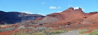
It’s a lovely drive, I’m so pleased I found this meandering scenic byway
where way below a long stark ridge juts hundreds of metres into the air. It’s the boundary for Castle Valley where I’m
headed.
Before the road takes its
inevitable descent I can see the tower I’m aiming for way in the distance,
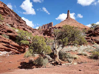
constantly thereafter offering different angles, posing like a tempting model. Before it is the massive Adobe Mesa, beside it The Rector and behind is Parriott Mesa, another great lump that apparently you can climb but
it’s done rarely.
In time I stumble on the carpark
for the tower. I use “stumble” advisedly
because there’s no sign as, around these parts, it’s one of the lesser
attractions. Again, some young folk have
camped here overnight in flimsy one-man, or woman as it turns out, tents.
Grabbing my phone I head off. Though it’s not very long (where I go) the
trail follows a dried-up watercourse and at two points it’s quite tricky
clambering over drops about two metres high.
One takes me a couple of minutes to negotiate, wondering if, indeed, I
can get up there and if it’s worthwhile, but after about ten minutes the scene
opens up with both peaks impressively standing out and I do a U-turn to ascend
a prominence that’s beside me.
It leads to a genuine 360 degree
panorama of Castle Valley and you can see a thin trail leading to the base of
Castleton Tower where the crazy climbers go.
I have no need to perform such deeds but I note there’s about four
younger people edging their way up the steep trail. It’s a massive base that’s been torn from the
rock over millennia but your eye is drawn to the heights.
Then I edge my way back down and
it’s off to Fisher Towers, my main goal for the day. It’s about another 20 kilometres and, as I
draw nearer to the turnoff, it’s clear I won’t be the only one there, though
when I reach the carpark there’s only a couple of dozen vehicles, small
potatoes by the numbers at Arches NP.
Even from the carpark this place
is impressive. Dramatic shafts of
surprisingly stable Permian Cutler sandstone (290 million years old) topped
with Triassic era Moenkopi sediments (240 million years) leave me gasping in
awe, even more so when I head off in the wrong direction (three trails, no sign
is my excuse) and end up in a small canyon.
The reward is a couple of unusual shots but I’m soon back heading in the
right direction of this 7 km out and back hike.
Immediately I come across people
pointing at one of the towers, the ever-popular (with climbers) Ancient Art
Tower with the squiggly bit on the top.
Sure enough, there’s athletes up there near the summit. Talk is that you’ll find someone up there
most days. They also have names for all
the other peaks, like Echo, Cottontail and Titan. Not sure where climbers dig them up!
Up close and personal these
formations are beyond impressive; they dominate you in a way few other rocks
I’ve ever walked beside do. They are SO
overpowering and the track meanders initially in the wash and then rises to the
bases where it follows them around.
As you curve past one bend the
wind if ferocious; starting on the opposite side and accelerating around the
U-shape until it hits you at something like 90 kph. It’s all I can do to hold onto my hat,
protect my eyes and try and keep dirt out of my mouth. Luckily I don’t have to worry about my camera
because I’ve only brought the phone.
After that buffeting it eases the
further you move and around the next corner there’s a short ladder you have to
climb down before getting on top of another watercourse and rounding the next
monolith, which is pretty close to where it all ends.
On the return leg I pay more
attention to the mushroom shaped rocks.
These are harder slabs that have fallen from way above aeons ago and
then the softer soil has eroded beneath them.
Rarely have I been made to feel so puny as I have beside this outcrop
and, for me, it’s better than anything Arches has to offer.
I’ve teamed up with a young man
named Corby and we swap traveller’s tales all the way back, making for a
pleasant interlude. It’s so nice to chat
with someone while you’re walking along, sometimes you simply forget just how
good it really is.


0 Comments:
Post a Comment
<< Home